| SOME MAPS AND PLANS OF ANI |
A selection of site plans of Ani
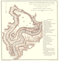
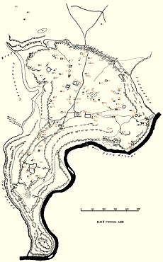
A plan of Ani from 1894, by H.F.B. Lynch.
A plan of Ani from 1934, by Nikoli Marr.
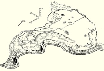
A bird's-eye view drawing of Ani from 1934, by Nikoli Marr.
A selection of maps showing the Kars and Ani region
A map of the Russian Caucasus, from the 1880s.
A map of the Kars region from 1901, an extract from H.F.B. Lynch's map of Armenia.
An extract from a modern Turkish map, showing the Kars and Ani region.